


Distance: | Time: | Difficulty (1-10): | Total ascent: |
% sealed: | % dirt: | % singletrack: | % hike-a-bike: |
This is a ride of contrasts. It begins in the lush forests of Mount Wilson, descends to the dry bush that lines the Hawkesbury and Colo rivers, and pops out on the the almost tropical Central Coast. You'll be pushing your bike up a washed-out disused firetrail, cruising along smooth sealed tarmac, and then descending on glorious dirt roads - all on the same day. The first night's camp is at a remote site only accessible by foot, and the second night's across the road from a rowdy historic pub.
If that's not enough to recommend this ride, you lose almost 1000 metres of elevation on the first day. That's a lot of downhill!
Route notes
Day 1
Though it's recommended you start this ride at Mount Wilson, it is possible to start at Bell train station. Doing so adds 17km of sealed road, about half of which is along Bells Line of Road. Sections of this road have no shoulder at all, and cars travel really fast, which is why we recommend against it.
Passing through Mount Wilson, you'll notice the vegetation is unusually lush for the Blue Mountains. This is because it sits on a basalt cap, providing rich nutrients for the rainforest ferns. The historic township has some immaculate gardens to gawk at as you ride through.
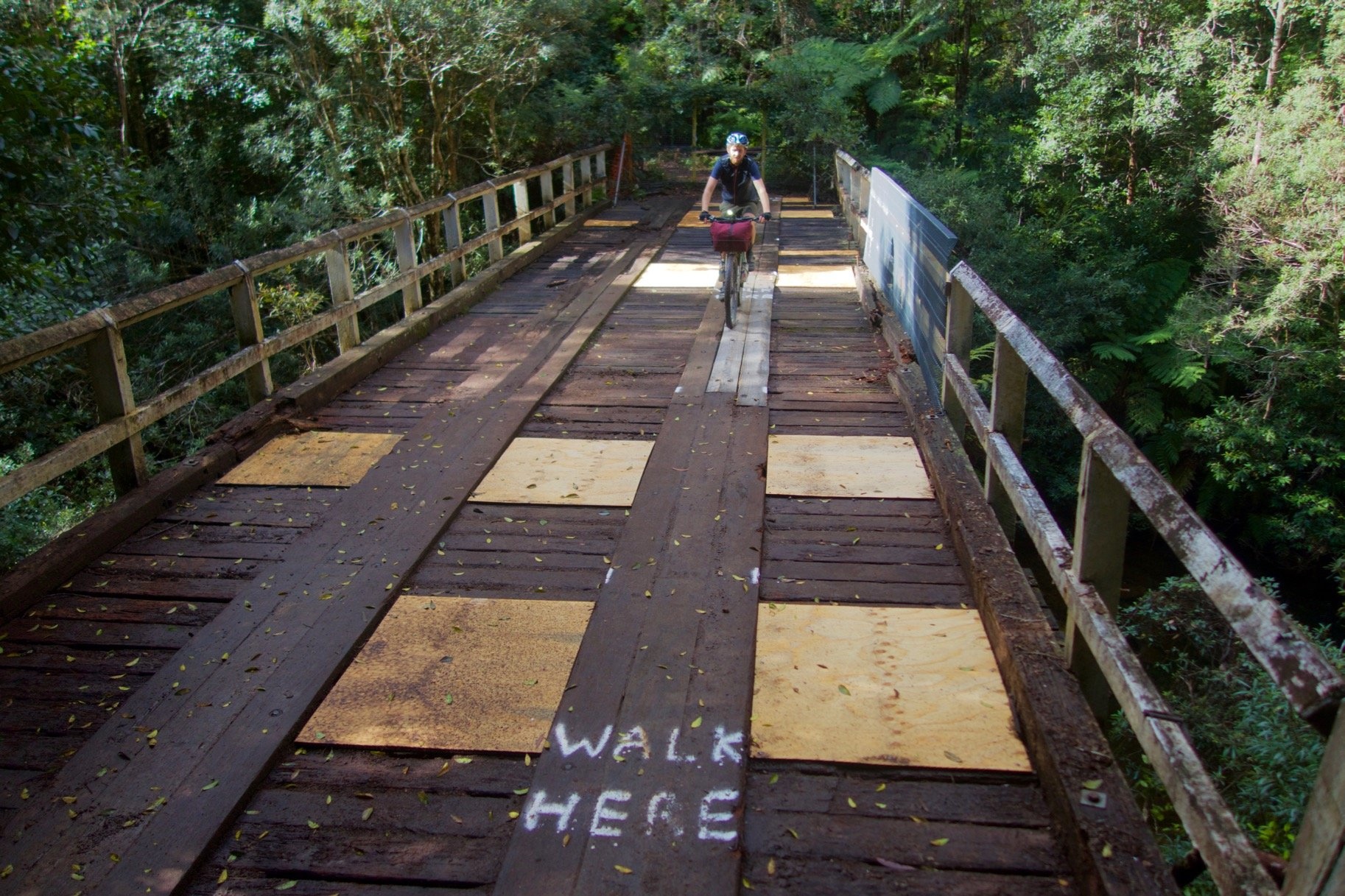
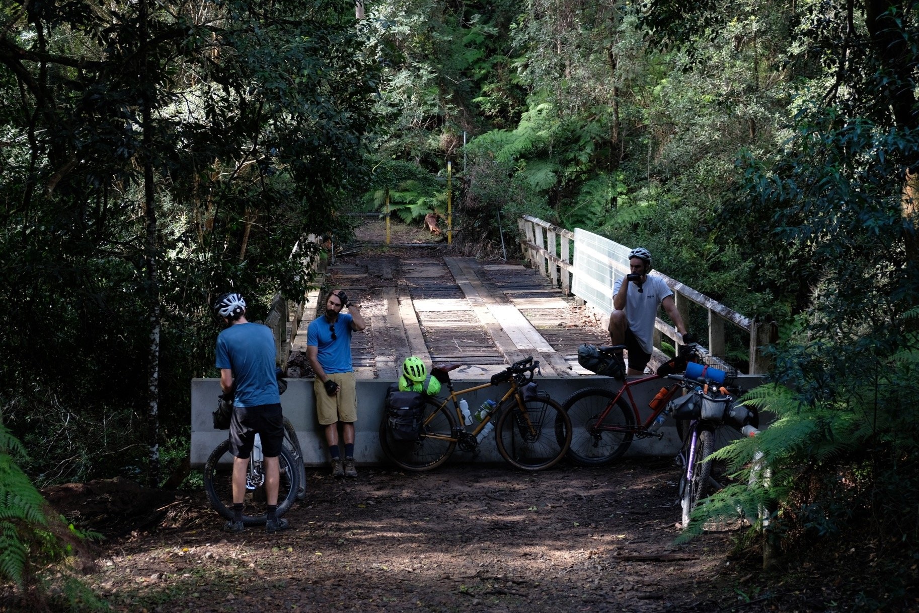
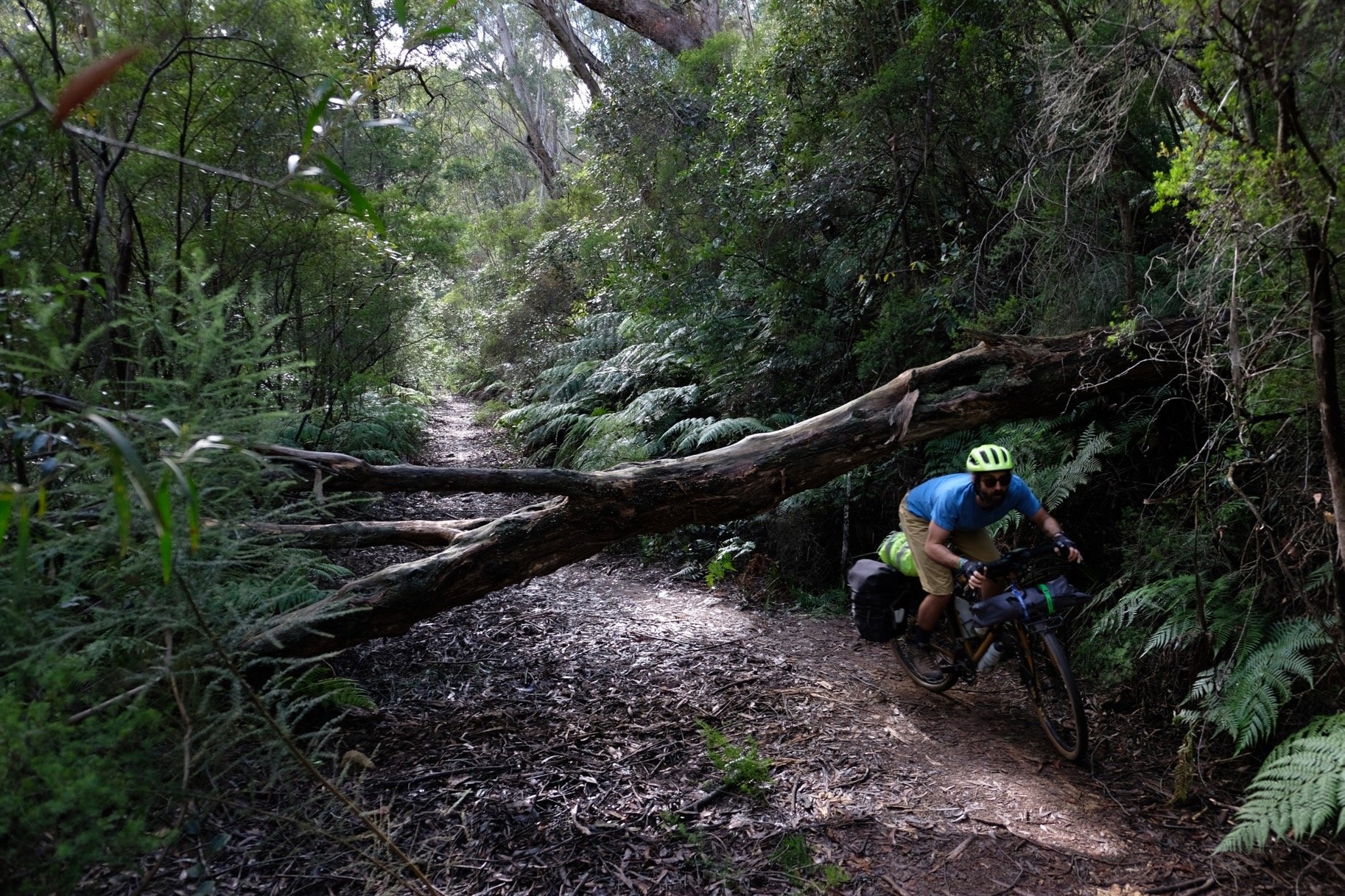
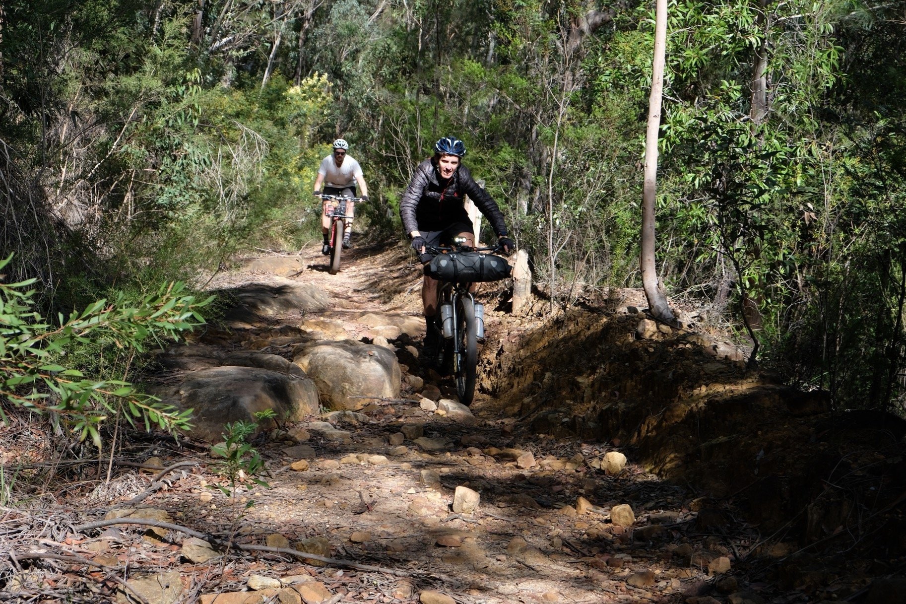
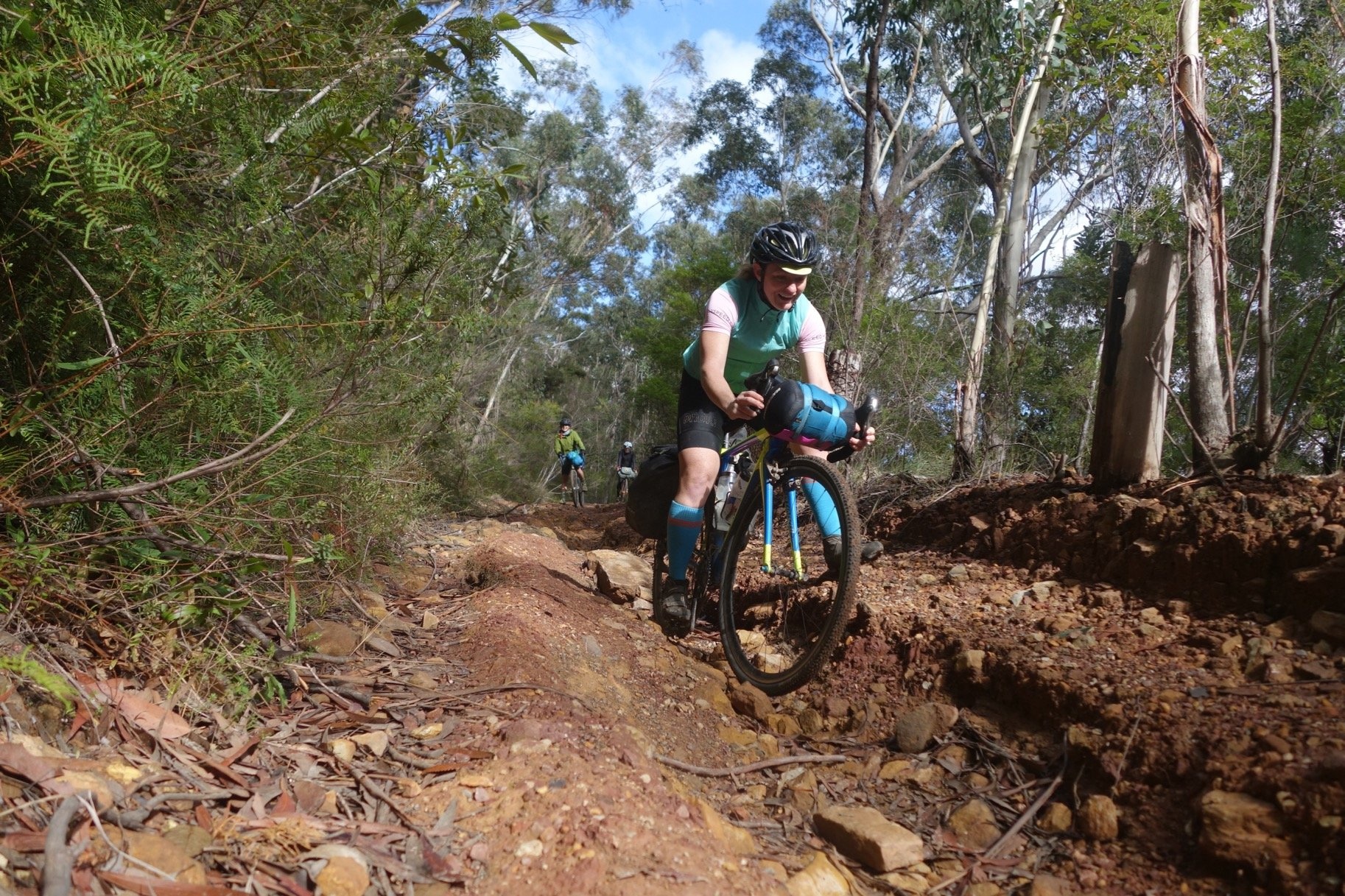
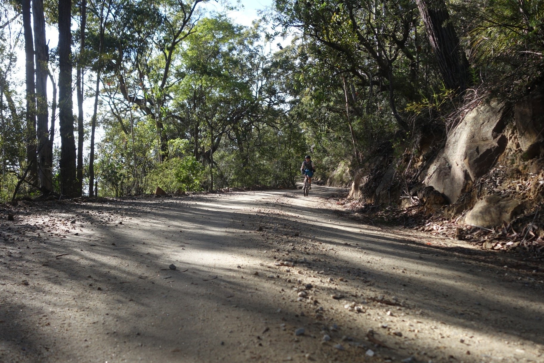
Past the town, there are some long downhill sections on the road (and short ups) that take you to the Mount Irvine turnoff. Keep going as the road turns to dirt, past the "ROAD CLOSED" signs (at your own risk of course). Descend down to Bowens Creek, and very carefully cross the rotting wooden bridge (stick to the newer planks of wood). [Edit: This bridge was destroyed in the 2020 bushfires. You can wade the creek upstream of the bridge.] On the other side you'll find the disused Mount Irvine fire trail, which zig-zags up through wash-outs and ruts to the Bells Line of Road.
Once you pop out onto the road, stick to the shoulder as traffic passes very fast. After a short ride you'll turn off towards Mountain Lagoon, a quiet collection of houses and hobby farms. The road turns to dirt again and after a short climb, you'll start the long descent to the Colo River.
Then follow the river west and north until you encounter some barriers on the track to the Colo Meroo campground. There is a right-of-way across some private properties, and one or two landowners have tried to enforce a "no bicycles" rule to keep people out. It's a legal grey area whether they have the power to do this, but the public is definitely allowed through, and in the interests of preserving access for future travellers, you MUST walk your bikes along the track from this barrier to the campground. If you ride your bike, a resident will see you (they're always watching) and you may jeopardise access (plus they'll probably yell at you). So just walk - it's a very pleasant half-hour walk.
The campground itself is very secluded and remote. Wander down the path to the river and enjoy sunset over the trees, as you sit in the shallows. Beware of possums eating your food!
Day 2
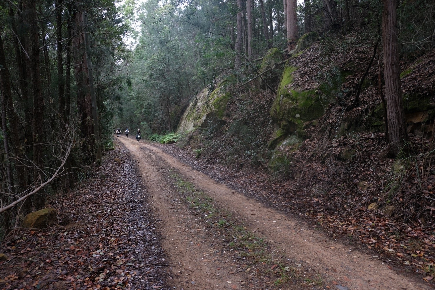
Head back the way you came (remember to walk your bike until you reach the barriers) until you reach Comleroy Rd. Continue riding alongside the Colo River and cross the wooden bridge at Upper Colo (as of February 2020 it has been washed away by floods, so check it's still there!) There's a lovely dirt climb, and then a relaxing roll past farms on Wheelbarrow Ridge Rd. This turns into the more adventurous Wheelbarrow Ridge Track, a dirt trail of varying quality. Eventually you drop off the ridge down to the Hawkesbury River, and crossing on the (free) ferry, you'll find yourself in the town of Wisemans Ferry. Once you're stocked up with supplies, take the other ferry north, and then follow the river to St Albans. There is free camping with a toilet block opposite the historic Settlers Arms Inn.
Day 3
Continue upriver past some spectacular wetlands, and climb through the bush back to the sealed George Downes Drive. This is a busy road with fast traffic, so put your lights on and keep left. After 7.5km you turn back onto the dirt, and after a few little rolling hills enjoy a steady flowing descent into the Yarramalong valley. There's a cafe to fuel up as you motor along the valley floor, and then one last big climb up onto the dirt again (passing the Ourimbah MTB Park in case you have the time, bike and skills to shred the gnar). Coming down out of the bush you'll jump onto the highway (the footpath is a shared path at some points so check signs to see if you can ride there), and soon you'll be at Ourimbah train station.
Map & GPS
Important details
Water and food sources
There are no shops in Mount Wilson, so stock up before you start. On day 1, there is a service station (meat pies, chips, soft drinks etc.) on the short stretch of Bells Line of Road between Mt Irvine Rd and Mountain Lagoon Rd. You can fill up water from Bowens Creek, and the Colo River at the campsite (treat all water along this route).
You'll reach the town of Wisemans Ferry on the afternoon of day 2, where you can stock up on food at a supermarket, and it has cafe food too. That's also the only place to fill up water on day 2, after you cross the Colo River. Our dinner suggestion is the Settlers Arms Inn at St Albans, just over the road from the campsite.
On the afternoon of day 3 you'll pass a service station/cafe at Yarramalong. There aren't any creeks to fill up from on day 3, so that's your only water point.
Weather and when to ride
This ride is best done from autumn to spring. Summer can be extremely hot and dry, with the risk of bushfires. It can get cold in winter (probably not below freezing), so check the forecast.
What to ride
Not for road bikes, but any tyres 32mm or larger should be fine. The roughest bit (ascent on Mt Irvine Rd from Bowens Creek) can be walked instead of ridden, and the rest is fairly good quality dirt road.